The island of Camiguin is part of the Northern Mindanao earthquake epicenter. It is basically volcanic in origin and is entirely made up of deposits attributed to its volcanoes. This volcanic island consists of the following seven volcanoes which have shaped both the land and the culture of its inhabitants:
Mt. Hibok-Hibok Mt. Vulcan Mt. Guinsiliban Mt. Mambajao Mt. Timpoong Mt. Tres Marias Mt. Uhay
There are also quite a number of smaller volcanic domes and parasitic cones such as Mt. Carling, Mt. Tibane and Piyakong Hill at the flanks of Mt. Hibok-Hibok, Campana Hill, Minokol Hill and the Tres Marias Hill at the flanks of Mt. Mambajao. Mt. Hibok-Hibok is an active volcano. It continues to manifest seismic activity and it only has a short repose period. The other six volcanoes are inactive, having no continued record of eruptions and their forms have started to change due to the agents of weathering and erosion and the formation of deep and long gullies on its slopes.
 |  |  |
| Mt. Timpoong | Mt. Hibok-Hibok | Mt. Vulcan |
 |  |  |
| Mt. Guinsiliban | Mt. Uhay | Mts. Vulcan & Hibok-Hibok |
The highest peak in the island is Mt. Timpoong which rises 1,580 meters (5,184 feet) above sea level. Mt. Mambajao stands 1,420 meters (4,659 feet) and Mt. Hibok-Hibok rises 1,240 meters (4,068 feet) above sea level. Not only is Mt. Mambajao the tallest, it is also the biggest volcano in the island. Because of the island's volcanic form, several hot sulfur springs and geothermal vents exists.
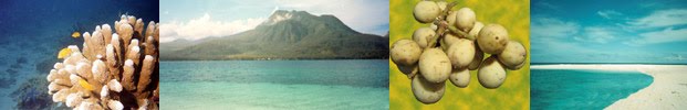
The volcanoes and the terrain of Camiguin Island pose limits on current and potential land use, and consequently, on the province's economic development. On the other hand, these qualities, particularly the volcanoes, make Camiguin unique and potentially enhance its attractiveness as a tourist destination. Despite the considerable destruction wrought by Hibok-Hibok's eruption in the early 1950s, Camiguin Island has flourished on its volcanic soils. The fertility of which has made the island conducive for the cultivation of coconut, copra, and other agricultural products.
MT. HIBOK-HIBOKLooming up behind the small capital town of Mambajao is Mt. Hibok-Hibok. This active volcano almost oblitereated the capital by a major eruption which started in September 1948 and lasted until 1953. Its minor eruption in 1948 caused little damage and loss of life. In 1949, its eruption caused 79 deaths due to landslides. In the morning of December 4, 1951, the most violent phase of the volcano's eruption occured. This time it unleased boiling lava which rolled down swifty toward Mambajao which was accompanied by poisonous gases, and landslides enough to destroy nearly 19 square kilometers of lands.
The speed and the high temperature of the avalanche which reached 800 degrees Celsius caused considerable damage in the affected areas. Trees were felled and charred, houses were burned down, animals and people were either charred or mummified. The eruption claimed more than 500 human lives and damaged properties and structures worth millions of pesos. Before the eruption of Mt. Hibok-Hibok in 1951, the population of Camiguin had reached 69,000. After the eruption, the population was reduced to about 34,000 due to mass departure of the island residents. In the years that followed, Camiguin's population grew from 57,126 in 1980 to 64,247 in 1990 an increase of 7,121 persons or 12.47 percent. In the last population count in 1995, there were already 68,039 residents which is just a little lower than its original population prior to the 1951 eruption.
The eruption of Mt. Hibok-Hibok has been classified as "Pelean," an eruption type considered to be one of the most dangerous because it is characterized by extrmemly viscous lava and the formation of glowing clouds of gas. The three photographs portrayed below were taken during the 1951 eruption of Mt. Hibok-Hibok.


Mt. Hibok-Hibok is an incandescent volcano and it consumes vast quantities of oxygen during an eruption that it kills by asphyxiation. After its major eruption in 1951, many persons were found dead as if they were merely asleep. This eruption prompted the Philippine government to create the Commission on Volcanology which is presently known as PHIVOLCS (Philippine Institute of Volcanology & Seismology).
The first recorded eruption of Hibok-Hibok ocurred in 1827. This was followed by a similar activity in 1862. Both eruptions caused destruction to arable lands. In the eruption of 1862, there were 326 deaths caused by ashflows that reached the sea. Some people drowned while trying to flee in small boats. In January 1871, earthquakes and subterranean rumbling sounds disturbed the northern end of Camiguin Island. Landslides and fissuring destroyed trees and plantations. When the swarm of earthquake ceased in April of the same year, an explosion followed and was accompanied by a shower of rocks, dust, and ashes. Destruction was complete within a radius of 1.86 miles (3 kilometers) from the new vent.
The eruption continued for a week and a volcanic dome called Vulcan began to form 2.17 miles (3.5 kilometers) from the general area of Mt. Hibok-Hibok. During this eruption most of the local residents fled the area after earthquakes that preceded the eruption. After four years of activity, the adventive lava dome reached a height of 1,500 feet (457 meters) with a base nearly 0.93 miles (1.5 kilometers) in diameter.
In 1897, the area occupied by the present dome of Mt. Hibok-Hibok emitted white sulfurous vapors which ruined agricultural lands nearby. Solfataric activity continued up to 1902 when a thunder storm occurred around the volcano and a new solfataric vent formed opposite the crest. Frequent subterranean sounds were noted during the activity which lasted for 8 to 10 days.
In every few years of activity, Mt. Hibok-Hibok seems to follow a cycle of behavior consisting of a short period of smoke emission from the crater and an avalanche of volcanic materials with or without accompanying tremors. There are explosions or steam blasts with emission of heavy clouds of steam, ashes and other fragmentary volcanic materials. The whole cycle covers a period of 9 to 14 months. Cold and hot mud flows, or lahar, develops especially after heavy rains so that now they pose another hazard to inhabitants living near the drainage channels of the volcano.
The approach for climbing Mt. Hibok-Hibok is at its base in Barangay Esperanza in Mambajao. Its steep slopes is a challenge to most seasoned climbers as the climb entails maneuvers in loose rocks and boulders. A dense, primeval forest covers every square foot of ground. There are tree ferns that thrive in the cool shade and springs bubble out of the ground. The summit of Mt. Hibok-Hibok is covered with loose ejecta and it has several craterlets at or near the crest, some representing shallow lakes. The present crateral area at the northeast slope facing Mambajao was mined for sulfur before the volcano's activity in 1948. At its crater is a lake and there are numerous steam vents and outlets which can be found at different locations.
Those who make the climb to its summit are rewarded with a magnificent panoramic view of the entire island including the nearby island of Bohol which can be seen on clear days. Although this mist-covered volcano is now quiet and inactive, the PHIVOLCS continue to monitor any unusual seismic activities for the safety of visitors and residents of the island. For those who intend an ascent of Mt. Hibok-Hibok, it is advisable to first pay a visit to the research and monitoring station to determine if it would be safe to make the climb. The station is located at 1,300 feet (396 meters) up on its slope.
Camiguin sure has a lot of valcanoes! That so amazing! I hope to visit some of them.
ReplyDelete